Technological innovation has revolutionized hydrogeological investigations, particularly in countries like Kenya, where complex terrain and diverse geological settings pose major challenges to borehole development. Among the most transformative technologies in modern groundwater exploration are Remote Sensing (RS) and Geographic Information Systems (GIS). These tools allow hydrogeologists and water resource planners to identify groundwater potential zones, analyze terrain and geological structures, and optimize borehole siting with improved accuracy and efficiency.
This article explores how Remote Sensing and GIS are integrated into hydrogeological surveys in Kenya, their methodologies, applications, and benefits, and how they are transforming decision-making in groundwater development.
Understanding Remote Sensing and GIS
Remote Sensing refers to the acquisition of information about an object or phenomenon without making physical contact, typically through satellite or aerial imagery. It captures data on surface features such as vegetation, land use, soil moisture, and structural geology.
Geographic Information Systems (GIS) involve the storage, analysis, and visualization of spatial data. GIS allows researchers to overlay different thematic maps (e.g., land use, geology, hydrology) to identify patterns and correlations relevant to groundwater occurrence.
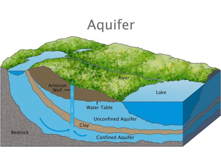
Relevance to Borehole Surveying in Kenya
Kenya’s topographic and geological diversity makes groundwater exploration both necessary and challenging. From the sedimentary coastal belt to the fractured basement rocks of the Eastern Province and the volcanic highlands of the Rift Valley, understanding subsurface hydrology is critical.
Remote Sensing and GIS offer significant advantages:
-
Enable large-area analysis prior to expensive fieldwork
-
Help identify lineaments, faults, and drainage patterns that control groundwater movement
-
Support groundwater potential mapping
-
Assist in decision-making and risk reduction in borehole siting
Key Remote Sensing Data Sources Used in Kenya
Several remote sensing platforms provide valuable data for hydrogeological applications:
| Satellite / Sensor | Data Provided | Application |
|---|---|---|
| Landsat 8/9 | Multispectral images | Land cover, soil, vegetation |
| Sentinel-2 | High-resolution optical images | Surface moisture, NDVI |
| ASTER | Thermal and elevation data | Lithology, temperature gradients |
| SRTM/DEM | Digital Elevation Models | Terrain, watershed delineation |
| MODIS | Climate and temperature | Long-term environmental monitoring |
These datasets are typically accessed freely and processed using GIS platforms such as ArcGIS, QGIS, or ERDAS Imagine.
Methodologies in Using Remote Sensing and GIS for Borehole Surveys
The integration of RS and GIS into hydrogeological surveys generally follows a structured workflow:
1. Data Acquisition and Preprocessing
-
Collect satellite images and DEMs for the study area
-
Correct images for atmospheric distortions (radiometric and geometric correction)
-
Mosaic and clip images to area of interest
2. Lineament Mapping
-
Use edge enhancement and filtering techniques to extract lineaments (linear features on the ground surface representing faults or fractures)
-
Lineament density maps are generated to highlight zones of potential groundwater accumulation, especially in fractured rock terrains
3. Thematic Layer Development
Create spatial layers such as:
-
Lithology (rock types)
-
Land use/land cover
-
Drainage and watershed networks
-
Slope and aspect
-
Soil types
-
Rainfall distribution
4. Weighted Overlay Analysis
-
Assign weights to each thematic layer based on its influence on groundwater occurrence
-
Combine layers in GIS using Multi-Criteria Evaluation (MCE) techniques
-
Generate a Groundwater Potential Map classifying areas into high, moderate, or low potential
5. Field Validation
-
Use GPS to ground-truth predicted high-potential zones
-
Conduct geophysical surveys (e.g., Vertical Electrical Sounding) at validated points
Applications of Remote Sensing and GIS in Kenya’s Borehole Development
a) Groundwater Potential Zonation
GIS and RS enable the categorization of large areas into zones with varying groundwater potential. This is especially important in ASAL counties like Turkana, Garissa, and Marsabit, where drilling risks are high and data is scarce.
b) Drought Monitoring and Water Resource Planning
By analyzing vegetation indices (e.g., NDVI) and soil moisture trends, planners can monitor drought conditions and identify regions most in need of groundwater interventions.
c) Borehole Siting and Prioritization
Instead of randomly selecting sites, surveyors can prioritize locations based on spatial analyses, reducing dry borehole rates and improving water access.
d) Catchment and Watershed Analysis
Using DEMs, GIS can delineate catchment boundaries, identify recharge zones, and evaluate surface runoff characteristics—all essential in designing groundwater recharge interventions.
Case Study: GIS-Aided Borehole Survey in Kajiado County
A GIS-integrated hydrogeological study in Kajiado in 2022 combined Landsat imagery, SRTM DEMs, and geological maps to generate a groundwater potential model. The study identified:
-
High lineament density along fault lines near Ngong hills
-
Moderate potential in volcanic ash regions
-
Low potential in compacted basement zones
Subsequent field verification confirmed that 80% of the boreholes drilled in high-potential zones had yields exceeding 8 m³/hr—demonstrating the power of RS and GIS in reducing borehole failure rates.
Benefits of Remote Sensing and GIS in Hydrogeology
| Benefit | Description |
|---|---|
| Cost-effective | Covers large areas at low cost before fieldwork |
| Time-saving | Speeds up decision-making and reduces trial-and-error |
| Data-rich | Offers historical, climatic, and spatial insights |
| Scalable | Suitable for county-wide or national mapping efforts |
| Predictive power | Identifies trends and patterns not easily visible on the ground |
Limitations and Considerations
While RS and GIS offer powerful tools, they also come with caveats:
-
Require skilled interpretation: Misclassification can lead to wrong conclusions
-
Not a substitute for field surveys: Ground-truthing remains essential
-
Temporal limitations: Some satellite data may not be up to date or cloud-free
-
Resolution constraints: High-resolution images may be costly or unavailable
Thus, these tools are best used in complement with traditional hydrogeological and geophysical techniques.
The Role of Institutions and Policy
Kenyan institutions such as the Water Resources Authority (WRA), Ministry of Water, and universities are increasingly adopting RS and GIS in water planning.
National initiatives like the Groundwater Mapping Project by the Ministry of Water and the Kenya Water Security and Climate Resilience Program utilize GIS-based groundwater models to inform investments.
There is also growing emphasis on training county governments and local consultants in using open-source GIS tools (e.g., QGIS), which democratizes access to technology and builds local capacity.
Future Trends
Emerging trends that will enhance RS and GIS in groundwater surveying include:
-
Machine learning and AI for pattern recognition in satellite data
-
Integration with IoT sensors for real-time groundwater monitoring
-
Mobile GIS applications for in-field data collection
-
3D hydrogeological modeling combining geophysics, drilling logs, and GIS
Such innovations will further reduce uncertainty in borehole development and support Kenya’s efforts in achieving universal access to safe water.
Conclusion
Remote Sensing and GIS have transformed the landscape of hydrogeological surveying in Kenya. By enabling smarter, data-driven decisions, these technologies improve borehole success rates, optimize resource use, and promote sustainable groundwater development. While not a replacement for field surveys, RS and GIS serve as indispensable tools in the modern hydrogeologist’s toolkit—especially in a country where water scarcity and climate variability continue to challenge communities and planners alike.