
Hydrogeological Mapping and Field Reconnaissance in Kenyan Groundwater Surveys
Hydrogeological mapping and field reconnaissance are foundational steps in any groundwater investigation. In Kenya—where geological formations vary from volcanic highlands and fractured basement terrains to sedimentary basins and coastal aquifers—understanding the hydrogeological context is essential before any borehole drilling begins. Hydrogeological mapping provides a visual and analytical representation of the subsurface water system, while field reconnaissance bridges the gap between desk-based…
Read more
1

Cost Differences in Hydrogeological Surveys Based on Location and Methodology in Kenya
Rahm
- June 10, 2025
- 1134 views
2

3

The Role of Remote Sensing and GIS in Borehole Surveying in Kenya
- June 10, 2025
- 218 views
4
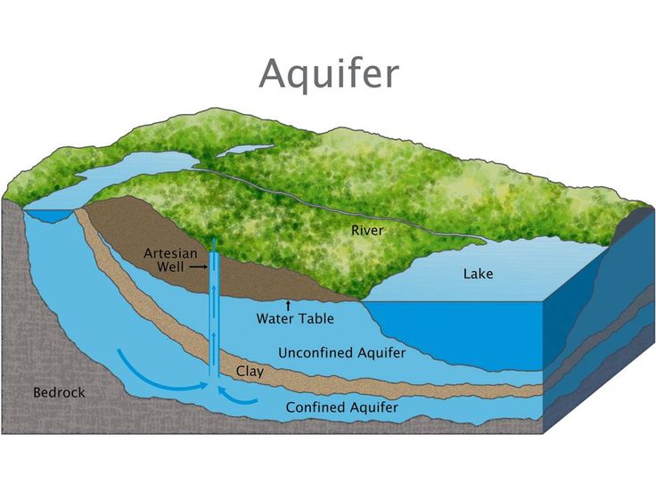
Understanding Aquifer Types and Groundwater Occurrence in Kenya’s Geological Formations
- June 10, 2025
- 662 views
5

Cost Breakdown of Hydrogeological Surveys for Borehole Siting in Kenya
- June 10, 2025
- 400 views
6
Hydrogeological Mapping and Field Reconnaissance in Kenyan Groundwater Surveys
- June 10, 2025
- 156 views