
The Role of Remote Sensing and GIS in Borehole Surveying in Kenya
Technological innovation has revolutionized hydrogeological investigations, particularly in countries like Kenya, where complex terrain and diverse geological settings pose major challenges to borehole development. Among the most transformative technologies in modern groundwater exploration are Remote Sensing (RS) and Geographic Information Systems (GIS). These tools allow hydrogeologists and water resource planners to identify groundwater potential zones, analyze terrain and geological structures, and…
Read more
1

Cost Differences in Hydrogeological Surveys Based on Location and Methodology in Kenya
Rahm
- June 10, 2025
- 1137 views
2

3
The Role of Remote Sensing and GIS in Borehole Surveying in Kenya
- June 10, 2025
- 220 views
4
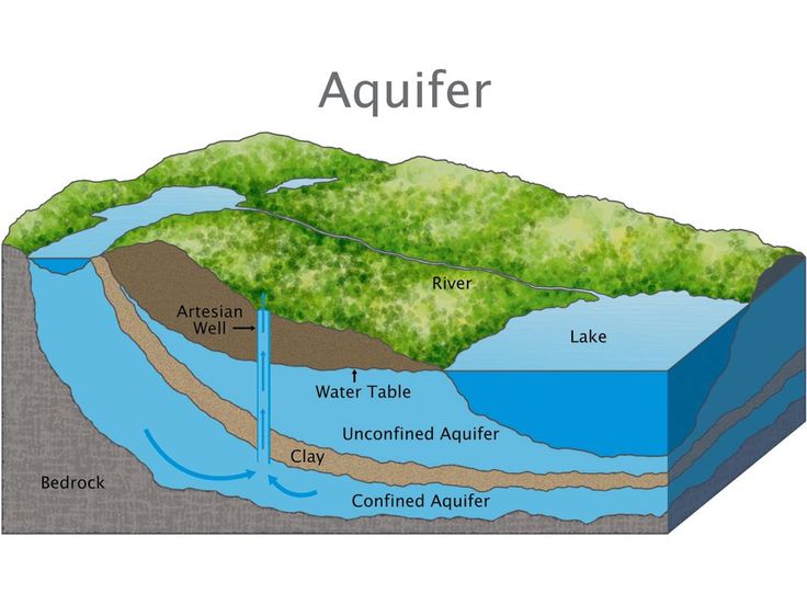
Understanding Aquifer Types and Groundwater Occurrence in Kenya’s Geological Formations
- June 10, 2025
- 663 views
5

Cost Breakdown of Hydrogeological Surveys for Borehole Siting in Kenya
- June 10, 2025
- 402 views
6

Hydrogeological Mapping and Field Reconnaissance in Kenyan Groundwater Surveys
- June 10, 2025
- 159 views