Before any boots hit the ground in a hydrogeological survey for boreholes or wells in Kenya, a crucial foundational step must occur: the desk study and literature review. This phase forms the backbone of any groundwater exploration initiative. It provides the contextual and technical information necessary to plan an effective and efficient field investigation. In Kenya, where diverse geological formations and variable climatic conditions prevail, a well-executed desk study ensures that hydrogeological surveys are grounded in scientific evidence and aligned with the regulatory framework.
The Purpose of a Desk Study
A desk study serves to collect, evaluate, and synthesize all available background data related to the hydrogeology of the area in question. This includes geological, hydrological, topographical, climatic, and socio-economic data. The ultimate aim is to reduce uncertainty, avoid unnecessary field costs, and increase the likelihood of successful borehole siting.
The process helps determine:
-
Whether groundwater is likely to be available.
-
What the quality and quantity of the water might be.
-
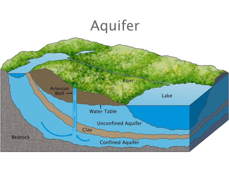
What type of aquifer system is likely present.
-
Any potential environmental or legal constraints.
In Kenya, where hydrogeological conditions can change dramatically from one region to another—ranging from volcanic highlands to arid plains—a desk study allows surveyors to tailor their approach according to the unique characteristics of each region.
Key Data Sources for Desk Studies in Kenya
1. Geological Maps and Reports
The Kenya Geological Survey under the Ministry of Mining and the Geological Society of Kenya have produced numerous geological maps. These documents provide insights into rock types, fault lines, and other structural features that influence groundwater flow.
2. Hydrological and Hydrogeological Data
The Water Resources Authority (WRA) maintains a repository of borehole logs, pumping test data, and aquifer characteristics. This data is vital for understanding past exploration results and guiding current efforts.
3. Topographic and Satellite Maps
Topographic maps help in identifying elevation gradients, drainage patterns, and surface features. Satellite imagery and aerial photographs can also reveal potential recharge zones, lineaments, and water bodies.
4. Rainfall and Climate Data
The Kenya Meteorological Department provides essential climatic data that affects groundwater recharge and surface runoff. Understanding seasonal rainfall patterns is critical, especially in semi-arid and arid regions.
5. Soil and Land Use Maps
Soil characteristics influence infiltration and percolation of surface water. Land use maps, such as those produced by Kenya’s National Land Commission or county governments, help assess human activity and potential pollution risks.
6. Previous Studies and Academic Research
Theses, dissertations, and published research from institutions such as the University of Nairobi, Kenyatta University, and Jomo Kenyatta University of Agriculture and Technology (JKUAT) often contain case studies and localized hydrogeological insights.
7. Regulatory and Legal Documentation
Understanding legal frameworks from WRA, NEMA, and county-level water authorities ensures that the survey complies with relevant laws and guidelines.
Methodology of a Desk Study
The desk study involves several methodological steps:
Step 1: Define the Scope
Clearly outline the area of interest, objectives of the groundwater development, and specific questions the study needs to answer.
Step 2: Data Collection
Gather all existing data related to the region. This may involve visiting government departments, universities, and NGOs, or accessing digital databases.
Step 3: Data Evaluation
Critically assess the quality, relevance, and reliability of each data source. Outdated or poor-quality data must be identified and either updated or supplemented with field validation later.
Step 4: Data Integration and Interpretation
Overlay different data types using Geographic Information Systems (GIS) to identify promising groundwater zones. This step often leads to the generation of preliminary maps and conceptual hydrogeological models.
Step 5: Risk Assessment
Evaluate potential risks such as saline intrusion, pollution, over-extraction, or geological hazards that might compromise water supply.
Advantages of a Desk Study
-
Cost-Effective: Significantly reduces the need for blind field investigations.
-
Time-Saving: Enables efficient planning and allocation of resources.
-
Strategic Decision-Making: Facilitates informed choices on borehole siting, depth targets, and drilling methods.
-
Compliance Assurance: Helps meet WRA’s requirements for pre-drilling documentation.
-
Community Insight: Historical data can shed light on local water use patterns and past failures or successes in borehole development.
Case Example: Desk Study in Kajiado County
Kajiado, located in the semi-arid region of southern Kenya, has experienced extensive groundwater development due to rapid urbanization. A desk study for a borehole project in Kitengela town included:
-
Geological mapping that revealed fractured basement rock as the dominant aquifer system.
-
Historical borehole data that showed variable yields, with depths ranging from 100 to 250 meters.
-
Rainfall data indicating recharge mostly during April–May and October–November.
-
Land use data highlighting increased impermeable surfaces, reducing recharge rates.
The desk study recommended targeted geophysical surveys near fault zones for higher success rates. The final borehole, sited based on this study, yielded 5 m³/hour, sufficient for domestic and livestock use.
Limitations of Desk Studies
While invaluable, desk studies are not foolproof. Some limitations include:
-
Data Gaps: In many rural or remote areas, historical data may be scarce or non-existent.
-
Outdated Information: Geological maps may not reflect recent changes due to urbanization or natural events.
-
Limited Precision: Desk studies can guide where to look, but they cannot confirm aquifer presence or yield without fieldwork.
These challenges underscore the need for integrating desk studies with field-based methods such as geophysical surveys and test drilling.
Integration with Subsequent Survey Phases
Once the desk study is complete, its outputs—maps, models, and risk assessments—form the basis for:
-
Geophysical survey planning (e.g., deciding the type and number of profiles).
-
Budgeting and logistics (e.g., estimating depth to water, equipment needed).
-
Stakeholder engagement (e.g., sharing expected outcomes with communities or clients).
-
Application for permits (e.g., attaching findings to the WRA Form A application).
Conclusion
The desk study and literature review are indispensable in Kenya’s hydrogeological surveying process. They provide the initial understanding of the geological, hydrological, and socio-economic context of a potential borehole site. When well-conducted, they reduce costs, enhance the success of borehole drilling, and ensure compliance with national regulations. As water demand continues to rise amid climate variability and population growth, the importance of scientifically grounded groundwater exploration cannot be overstated.
In the dynamic and often unpredictable Kenyan terrain, a solid desk study is the first and most critical step toward sustainable groundwater development.