Remote sensing and satellite imagery have become increasingly vital tools in hydrogeological surveys, offering a bird’s-eye view of the landscape and unlocking valuable data on geological structures, surface features, and hydrological systems. In Kenya, a country marked by diverse climatic zones and topographical variation, remote sensing is particularly useful for identifying promising groundwater sites—especially in remote or poorly mapped areas.
This blog explores how remote sensing and satellite imagery are applied in hydrogeological surveys for boreholes and wells in Kenya, examining the methods, technologies, cost implications, advantages, and case examples that highlight its growing relevance in water resource development.
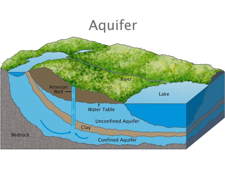
What is Remote Sensing?
Remote sensing refers to the process of obtaining information about an object or area from a distance, typically through satellite or aerial sensors. These sensors capture data in various bands of the electromagnetic spectrum, which can be analyzed to reveal patterns and features that are not easily visible to the naked eye.
In the context of hydrogeology, remote sensing helps identify:
-
Geological lineaments (faults, fractures)
-
Drainage patterns and water bodies
-
Vegetation anomalies
-
Soil moisture content
-
Land use and land cover changes
All these indicators are essential for inferring the presence, movement, and storage of groundwater.
Why Remote Sensing Matters in Kenya
Kenya’s varied geological framework—from basement complexes to volcanic terrains and sedimentary basins—requires adaptive survey tools. Many parts of the country, particularly in the arid and semi-arid lands (ASALs), are difficult to access and have limited ground data. Remote sensing overcomes these limitations by providing:
-
Wide-area coverage
-
Historical time series
-
Up-to-date environmental monitoring
-
Cost-effective reconnaissance over large regions
Additionally, with increasing groundwater exploitation and land use changes, remote sensing enables continuous monitoring and planning to ensure sustainability.
Key Satellite Data and Tools Used in Kenya
Several satellite systems and remote sensing platforms are commonly used in Kenyan hydrogeological applications:
1. Landsat Imagery
-
Provides multi-spectral images with a resolution of 30 meters.
-
Useful for identifying vegetation indices (NDVI), surface water, and geological structures.
2. Sentinel-2 (European Space Agency)
-
Higher resolution (10–20 meters) and shorter revisit time.
-
Ideal for mapping recent land cover changes and hydrological features.
3. ASTER (Advanced Spaceborne Thermal Emission and Reflection Radiometer)
-
Offers thermal and elevation data that assist in identifying lineaments and geological structures.
4. MODIS (Moderate Resolution Imaging Spectroradiometer)
-
Used for large-scale climatic and environmental observations such as rainfall and evapotranspiration trends.
5. Google Earth and Digital Elevation Models (DEMs)
-
Widely accessible and useful for topographical analysis, slope determination, and drainage delineation.
6. GIS Software
-
Platforms like ArcGIS, QGIS, and ENVI are used to process and interpret remote sensing data.
Methodology of Remote Sensing in Hydrogeological Surveys
The remote sensing process typically follows these steps:
Step 1: Define Study Objectives and Area
The survey area is georeferenced, and goals such as detecting aquifer zones or mapping faults are established.
Step 2: Satellite Image Acquisition
Imagery is downloaded from public or commercial sources based on spatial and spectral resolution needs.
Step 3: Image Pre-processing
Includes geometric correction, atmospheric correction, and image enhancement to improve accuracy and clarity.
Step 4: Image Classification and Interpretation
Spectral signatures are used to classify surface features such as vegetation, water, urban areas, and bare land. Tools like NDVI (Normalized Difference Vegetation Index) help indicate zones with higher moisture content.
Step 5: Lineament Mapping
One of the most critical hydrogeological applications. Lineaments are extracted using edge-detection and filtering techniques, indicating potential fault zones and groundwater conduits.
Step 6: Integration with Other Data
Remote sensing data is overlaid with geological maps, borehole logs, and geophysical data for comprehensive site evaluation.
Advantages of Remote Sensing in Kenyan Groundwater Exploration
1. Wide Coverage
Enables assessment of vast areas such as Turkana, Marsabit, or Tana River counties with minimal physical presence.
2. Non-Invasive
Ideal for environmentally sensitive or protected areas where ground disturbance is limited.
3. Time-Saving
Reduces field survey times and helps prioritize the most promising sites.
4. Cost-Efficient
Initial costs may include software and data acquisition, but they pale in comparison to unnecessary drilling in non-productive areas.
5. Multitemporal Analysis
Allows monitoring of seasonal changes, recharge events, and drought impacts over time.
Limitations and Challenges
While highly beneficial, remote sensing also has its challenges:
-
Resolution Constraints: Medium-resolution satellites may miss small-scale features.
-
Cloud Cover: Especially problematic in highland or equatorial regions.
-
Ground Truthing Required: Satellite interpretations must still be verified on the ground using geophysics or test drilling.
-
Technical Skills: Requires trained personnel to interpret spectral signatures and integrate datasets.
Case Example: Remote Sensing in Northern Kenya
In 2013, a major water resource mapping initiative was conducted in Turkana County using satellite data and radar technology. The project, supported by UNESCO and Radar Technologies International (RTI), employed advanced remote sensing to locate a large aquifer known as the Lotikipi Basin.
-
Data Used: Satellite radar and seismic data
-
Findings: Presence of a 200 billion m³ aquifer with potential to supply water for decades
-
Outcome: Drilling confirmed groundwater availability, although salinity and sustainability remain under review
This case underscored the potential of remote sensing to revolutionize groundwater exploration in Kenya’s driest regions.
Cost Considerations
The cost of remote sensing applications can vary depending on the type of imagery and processing requirements:
| Component | Cost Range (KES) |
|---|---|
| Free satellite imagery (e.g., Landsat, Sentinel) | 0 |
| High-resolution commercial imagery (e.g., SPOT, WorldView) | 10,000 – 50,000 per scene |
| GIS and remote sensing software | 20,000 – 200,000 (license-dependent) |
| Image analysis and consulting services | 50,000 – 300,000 (per project) |
These costs are often justifiable considering the potential savings on unsuccessful borehole drilling.
Integration with Other Survey Methods
Remote sensing works best when integrated with:
-
Desk Studies (for historical and regulatory context)
-
Geophysical Surveys (to confirm subsurface structures)
-
Hydrochemical Analysis (to evaluate water quality in target zones)
This integrative approach increases the probability of striking high-yield aquifers and reduces the overall risk in groundwater development projects.
Conclusion
In the dynamic hydrogeological landscape of Kenya, remote sensing and satellite imagery have emerged as transformative tools for groundwater exploration. They enhance the efficiency, coverage, and accuracy of surveys—particularly in areas where conventional methods fall short. While remote sensing is not a standalone solution, its integration into a comprehensive hydrogeological study provides invaluable insights that can guide policy, investment, and sustainable water development.
As technology continues to evolve, and as Kenya grapples with growing water scarcity, remote sensing will only become more critical in the search for reliable and sustainable groundwater sources.